Google has been branching out in a big way recently. No longer limited by the Internet, Google is seeking new and exciting ways to allow its users to interact with the real world in a digital way. Along with the development of augmented reality eyewear and self-driving cars, Google Earth was first to show us the planet from space. Now Street Views will take us below sea level.
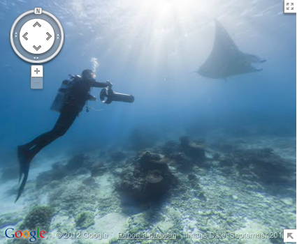
Google just launched new 3D interactive maps of six of the world’s most incredible coral reefs. This new deep-sea adventure gives anybody with internet access the ability to investigate majestic locations up close and personal without leaving their home. With Google Street View, now you can drive right down the beach and dive under the sea (virtually of course), with access to an ocean experience you probably never dreamed possible from a computer.
The new Street View feature is being introduced with much excitement on the official Google blog, even featuring a Google+ hang out live from the Great Barrier Reef! The new underwater panoramas are seamlessly incorporated into Google maps, giving you (the Google user) an even more complete view of the world around you. Google seems to be making serious progress in their mission to image the entire planet.
So what’s next for Google? Only time will tell. One thing’s for certain: Google is running out of new things to take pictures of on THIS planet. For those who have been bitten by the space bug after the success of the Mars Science Laboratory “Curiosity”, this is bound to get you pretty excited.
For more stunning, underwater Street View images, check out the gallery here.